...WIND ADVISORY IN EFFECT FROM NOON TODAY TO MIDNIGHT CST TONIGHT...

* WHAT...West winds 20 to 30 mph with gusts up to 45 mph expected.
  Localized higher gusts are possible.

* WHERE...Portions of north central, northwest, and west central
  Illinois, east central, northeast, and southeast Iowa, and
  northeast Missouri.

* WHEN...From noon today to midnight CST tonight.

* IMPACTS...Gusty winds will blow around unsecured objects. Tree
  limbs could be blown down and a few power outages may result.
- Multi-faceted system with rain, strong winds (Wind Advisory in effect), plummeting temps and scattered snow showers expected over the next 12 hours.
- Travel impacts are possible for the evening commute. If any wet pavement lingers as temperatures plummet by mid afternoon into early evening it could refreeze and lead to slick and potentially hazardous travel. Much lower confidence though on how wet pavement will be when this much colder air arrives. In addition, scattered snow showers are expected 2-9 PM. Any falling snow combined with strong winds could lead to localized very poor visibility for short periods of time. Little snow accumulation is expected.
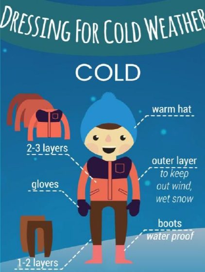
- Bitter cold tonight and Friday morning with wind chills 0 to -15.